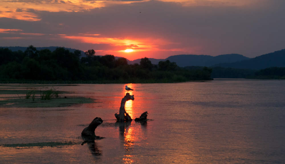

Our Lake
Lake Onalaska is a 7,688 acre body of water created when Lock and Dam #7 inundated former backwater areas of the upper Mississippi River in 1937. The entire Lake is within the Upper Mississippi National Wildlife and Fish Refuge and almost all of the shorelands surrounding the Lake are owned by federal agencies (U.S. Fish and Wildlife Service and U.S. Army Corps of Engineers). The Lake Onalaska Protection and Rehabilitation District is an association of property owners whose land adjoins the federal shorelands, formed under Wisconsin Statutes, to play a role in the planning and management of the Lake's resources (more info.). Lake Onalaska has abundant fish resources, is an important refueling stop for large numbers of long-distance migrating waterfowl and other birds in spring and fall, and provides diverse human recreational interests.
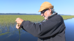
Mississippi River Flyway Cam on Sommers Chute delta in Lake Onalaska
Issues
All of the issues with our lake are linked together:
-
Sedimentation: sandbar shoaling at inflow locations and silt dropout throughout the lake have caused Lake Onalaska to lose about 3/4 of its volume since its creation in 1937. Shallowing waters impact fish as well as deepwater-foraging waterfowl species like canvasback.
-
Access: Shoaling from sedimentation and excessive nutrient-fueled vegetation growth hamper access waterways throughout the lake. Vegetation cutting in the access travel routes temporarily helps.
-
Poor water quality
-
Excessive external nitrogen and phosphorus inputs produce an overabundance of vegetation, choking access waterways, and depleting oxygen when the vegetation decays. Most of the excessive nutrients are from agricultural runoff. High phosphorus levels increase the probability of toxic blue-green algae blooms. Recent dramatic expansion of a native wild rice variant further chokes navigation channels and crowds out submerged aquatic vegetation upon which waterfowl and fish depend.
-
Low Oxygen: oxygen levels go to zero in still areas during summer evenings, impacting fish and invertebrates. Also in low flow areas during winter.
-
High Turbidity reduces light penetration, affecting submerged aquatic vegetation and fish.
News
Lake District 2023 Annual Meeting
The 44th Annual Meeting of the Lake Onalaska Protection and Rehabilitation District was held Wednesday August 30, 2023 at the City of Onalaska City Council Chambers at 435 Main St. Onalaska WI.
For details about the 2023 annual meeting and presentations visit the LOPRD meetings page.
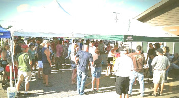
Lake Onalaska District Social, June 26, 2023 at Red Pines
The Lake District sponsored a social event at Red Pines Bar and Grill on Lake Onalaska, on June 26th from 5 to 8 p.m. All those who care about the Lake were welcome. The objective of the social was to learn about water quality, accessing the Lake, ongoing Lake studies, aquatic vegetation, and developing Lake dredging and other projects. Representatives from natural resource agencies attended to provide information on their agencies' programs that affect Lake Onalaska. There was also a presentation about the developing dredging project to provide fish overwintering habitat and lake access along the former North Shore Lane channel.
Lake Grant Monitoring Update
Monitoring programs are underway for the Lake District's 2023 Wisconsin Surface Water Grant:
Bathymetric Survey
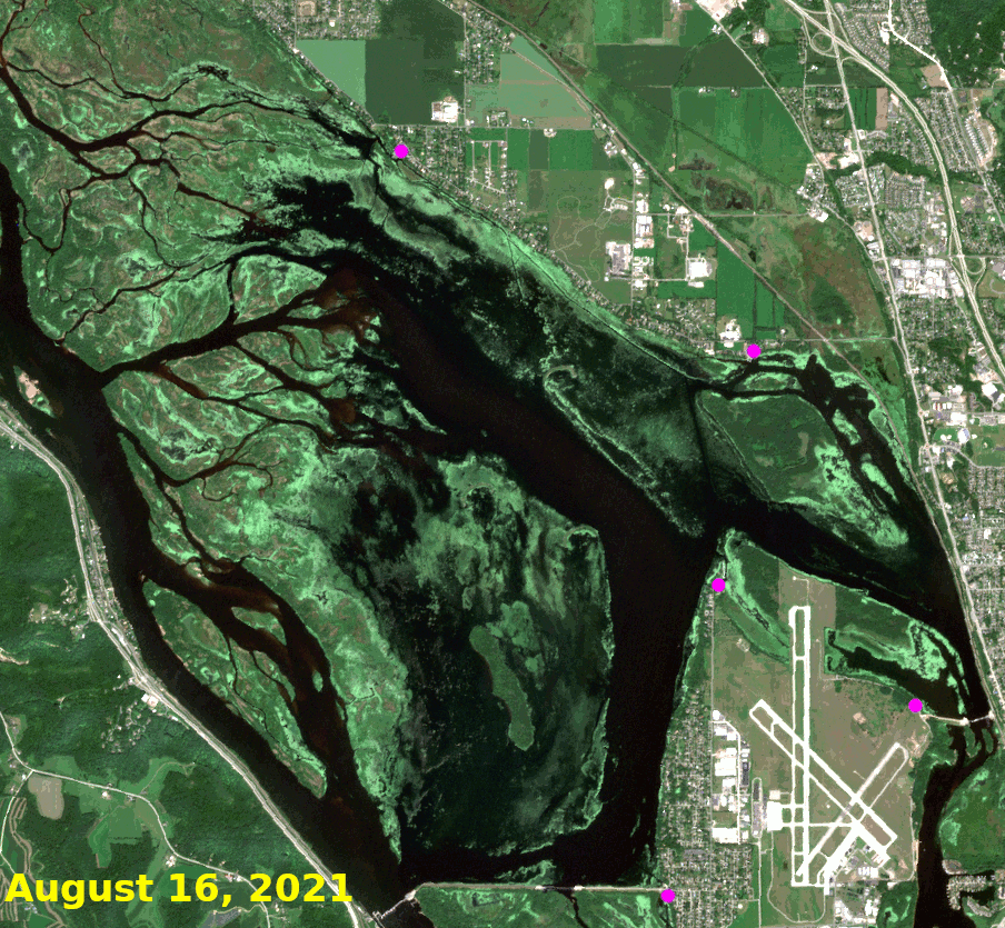
UW-L River Studies Center has been contracted for a hydroacoustic survey of eastern Lake Onalaska, including the "dredged channels" that provide primary fisheries overwintering habitat for Pool 7. The hydroacoustic survey is projected to begin in May or when flood waters sufficiently recede for boat operations.
Halfway Creek Monitoring
"Citizen Science" monitoring is underway to capture basic stream hydrology during high-flow sedimentation events as well as water quality to evaluate future, more rigorous, optimal sampling locations.
Detailed project log: Includes prior updates
Latest update: (April 19-20 Precipitation Event): A modest rain event dropped 1.7 inches of precipitation (averaged over 9 crowd-sourced weather stations within the Halfway Creek watershed) in the watershed during 3 rain periods. The trailcam-monitored staff gage at the Highway ZN culvert captured 3 subsequent discharge pulses:

Water in the stream became murky following the rainfall, but not nearly as bad as during the March 31 event. It was not possible to take Secchi observations of water clarity at the stream outfall because flooding conditions on Lake Onalaska and the upper Mississippi River precluded safe access.
Lake District Receives DNR Surface Water Grant
The Lake District was awarded a $10,000 grant from the Wisconsin DNR Surface Water program for a 2023 project to hydroacoustically map overwintering fish habitat loss in the dredged channel area of eastern Lake Onalaska, and to begin to study hydrology and sediment loading from Halfway Creek, which discharges directly into the dredge channel area.
Within Halfway Creek, citizen science monitoring will be used to characterize the timing, duration, and magnitude of peak event, high-sediment discharge flow events at multiple locations in the lower watershed. This will allow better placement of more rigorous hydrology and sediment monitoring resources proposed for future years, better formulation of a proposed 9-key element watershed plan for Halfway Creek, and increased understanding by local governments of flood-related issues in the lower watershed.
The upper portions of Halfway Creek are currently rated as Class 2 and 3 trout streams by Wisconsin DNR. Funding for Wisconsin DNR Surface Water grants comes from the Water Resources Account of the Conservation Fund , which draws from boat gas tax revenues.
Halfway Creek Marsh Project Tour
The Lake Onalaska Protection and Rehabilitation District organized a US Fish and Wildlife Service-led tour of the Upper Halfway Creek Marsh Project on Thursday October 20, 2022. The Marsh Project's 3 constructed-wetlands total 85 acres, and along with natural wetlands further downstream perform and important sediment and nutrient-trapping function for Halfway Creek before it discharges into Lake Onalaska.

Unfortunately, Halfway Creek continues to discharge large volumes of sediment to the Lake during periods of high flow, which are becoming increasingly more common. The outfall plume of sediment-laden discharge flows directly over important deepwater fish overwintering habitat which was created in 1989-90 during a multi-million dollar "Environmental Management Project" (the very first EMP project) which dredged a million cubic yards to create the important, but rapidly disappearing deepwater habitat. Detailed summary notes from the tour describe the project in more detail and discussions during the tour with local officials about continuing problems with Halfway Creek and potential solutions.
Lake District Annual Meeting, August 31, 2022
The Lake District held its annual membership meeting in the City of Onalaska council meeting room on August 31, 2022. For details about the 2022 annual meeting see the annual meeting pages.
2022 Lake Onalaska Project Raffle
Huge THANK YOU to our hardworking organizer Tony Christnovich and all of those who donated to help make our summer 2022 fundraiser a success! We raised over $22,000 which will be used for projects on Lake Onalaska.
Raffle winners were:
- Packer Tickets (donated by Bill Carskadon): Mike Berkeley
- Pontoon Rental from Schafers: Linda Watson
- Guided Walleye trip from Mike McCormick: Tom Ready
- 4 Kayak Rentals from Schafers: Tom Ready
- 251 Stihl Chain Saw (donated by Angry's Way Out): John Sheppard
- $250 Gift Card at Red Pines: Jerry Kobs
- Guided Ice Fishing from Mike McCormick: Robert Abraham
- Holmen Ace Hardware Gift Certificate for $100: Renee Overton
Lake District Annual Meeting, September 2, 2021
The Lake District held its annual membership meeting in the City of Onalaska council meeting room on September 2, 2021. Covid-19 precautions were observed, including wearing masks and social distancing. Agenda items and presentations included:
- Elections: Mark Tierney, Connie Welch, and Barbara Friell were re-elected to commissioner positions.
- 2021 budget
- Biology, history, and expansion of wild rice in Lake Onalaska,
- Extent of aquatic vegetation coverage of the Lake in 2021
- A new fundraising initiative for projects and vegetation harvesting
- Progress report on the sedimentation input initiative that is extremely important for the future of Lake Onalaska
For further details about the 2021 annual meeting see the annual meeting pages.
2021: Extensive vegetation coverage
The lack of high water events this summer allowed for more extensive aquatic vegetation growth in Lake Onalaska than has been seen for a number of years. Free-floating plant (FFP) surface mats, comprised of filamentous green algae and duckweed trapped in rooted submerged vegetation, covered extensive areas of the periphery of the lake, blocking sunlight from underlying rooted, submerged plants. This causes very low dissolved oxygen in the water under the FFP mats, particularly in the evening, which can preclude use of those areas by fish. The Wisconsin DNR acquired a time series of satellite imagery during July and August to study the growth of the FFP mats. In addition, wild rice (presumably Zizania aquatica, although the genetics may be uncertain) continued its aggressive expansion in 2021, moving well out into areas that were previously open water.
(click to enlarge)
Fundraising for Weed-Cutting in Travel Routes
The Lake District is kicking off a fundraising drive to support weed-cutting to maintain the "travel routes" that allow access from boat landings and shoreline areas to deepwater areas of Lake Onalaska and the main channel of the Mississippi River. The funds will be used to pay a contractor tocut and remove vegetation.
Please help our weed-cutting efforts with a donation through PayPal:
Donations by check can be mailed to:
BMO Harris Bank attn: Maggie Kanz 1300 Rose Street
La Crosse, WI 54603 Reference: "Lake Onalaska Weed Cutting Donation", account# xxxxx3889
Cutting vegetation to improve access was approved by a USFWS Compatibility Determination in 2019, for travel corridors within certain mapped areas of Lake Onalaska.
Increasing Annual Flow Impacting Lake Onalaska:
At the November 19, 2020 Lake District meeting, U.S. Army Corps of Engineers hydrologist Jon Hendrickson gave an excellent presentation entitled "Altered hydrology: Effects on Pool 7" in which he described some of the impacts of the Upper Mississippi's ever-increasing annual flow volumes. The higher flow rates are accelerating geomorphic change, increasing sediment deposition, altering flow patterns and impacting the floodplain forests. Pool 7 is probably the most significant example to date. Full presentation: file:20201119_Lake_Onalaska_PAS_Hendrickson.pdf
Lake District Annual Meeting, September 8, 2020
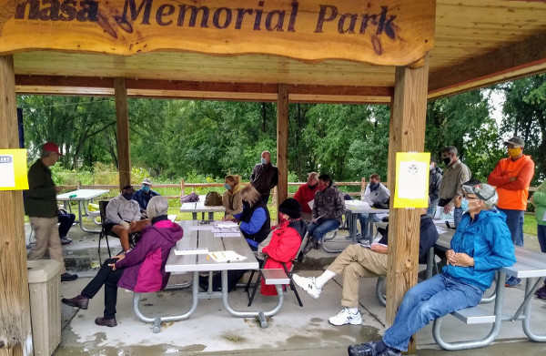
The Lake District held its annual membership meeting outdoors at the NASA Memorial Park Shelter adjacent to Mosey Landing on Brice Prairie on September 8, 2020. State statutes required an inperson meeting. Covid-19 precautions were observed, including wearing masks and social distancing. Turnout was lower than usual due to the setting and chilly 50 degree temperatures with light rain. Elections were held with Barbara Friell being re-elected, and Connie Welch voted into the seat formerly held by Jeff Reabe, who resigned at the end of his term. The District is moving forward with improving access by cutting vegetation in buoyed travel routes, and steps to create a lake management plan. Further details will be available in the draft meeting minutes and related links on the annual meeting pages.
Lake Planning Grant Submitted
The Lake Onalaska Protection and Rehabilitation District submitted an application for a Wisconsin Surface Waters grant for lake management planning in December 2019. The proposed project would describe the current status of Lake Onalaska and draft a comprehensive lake management plan. Existing data will be used to quantify lake loss from sedimentation; map submerged aquatic vegetation; inventory and identify gaps in monitoring data; summarize stakeholder and agency goals; clearly describe the management responsibilities of the complex overlapping local, state, and federal jurisdictions; and develop a management and information-sharing partnership framework. February 20 update: Surface water grant was not awarded.
More Aquatic Invasive Species Found on Lake Onalaska
In early October 2015, Water lettuce and water hyacinth were found rapidly spreading near the Brice Prairie shoreline after they were released from a garden pond. USFWS issued a news release about water lettuce on Pool 7. The Lake District has played a very active role in removing these species. For more information and a chronology of events see our invasive species page. No water lettuce or water hyacinth plants were reported during 2016.
In early June 2016, yellow flag iris, a restricted species in Wisconsin, was observed blooming in several isolated clumps near both Mosey Landing and Fred Funk landing on Brice Prairie. Lake District residents, USFWS and Wisconsin Rivers staff and other volunteers removed the plants. Yellow flag iris can spread widely through floating seeds and displaces native shoreland vegetation.
In 2020, invasive flowering rush spread its distribution into pools 7 and 8, with plants found on areas near the edge of Lake Onalaska.
Donate to the Lake District
The Lake Onalaska Protection and Rehabilitation District has the authority to levy a tax, but has only used that authority during two very early years of its existence. Since then it has relied on fundraising efforts. You can help our efforts by donations (please see the above link for weed-cutting donations)
Fred Funk Landing Reopened After Major Renovation
A grand re-opening celebration for the Fred Funk landing project was held on September 7, 2019. This landing provides access to the Mississippi River backwaters, including Lake Onalaska from Brice Prairie, adjacent to Swarthout Park. The renovations include installation of the following: two new boat ramps and adjacent asphalt surfaces, 2 new docks, LED light poles to increase visibility, ADA accessible sidewalks, 2 storm-water detention ponds, a 2 panel kiosk, a new entry sign (by Charlie Lipke) and new striping on the parking areas. An ADA accessible fishing platform will also be installed with funds provided by the U.S. Fish and Wildlife Service. The celebration was followed by a public pontoon tour rides, hosted by Schafer's Marine Services, to see a demonstration of a travel corridor established by aquatic vegetation cutting and removal and marked by red and green navigation buoys. This method will be used to create future boat travel corridors on Lake Onalaska.
COE Revising Its Master Plan:
The St. Paul District is updating the strategic land use and recreation management document that will guide the district"s comprehensive management and development of natural, recreational and cultural resources of the Upper Mississippi River basin for years to come. The master plan, while conceptual in nature, will serve as the vision for both environmental stewardship and recreation as the Corps continues to serve the public in the 21st Century. A series of public meetings were held over the summer of 2019. A revised draft plan is expected in early 2020. For more information see: www.mvp.usace.army.mil/Upper-Mississippi-River-Master-Plan/