Halfway Creek 2023 Monitoring and Project Log
The Lake Onalaska Protection and Rehabilitation received a 2023 Wisconsin Surface Water Grant, part of which involves citizen science monitoring on lower Halfway Creek. This monitoring will focus on high-discharge events, to set the stage for more rigorous scientific monitoring in the future. In addition to capturing some basic water quality and hydrology observations, this project will evaluate the suitability of 4 different sites for future monitoring equipment placement to best capture high-discharge events in the future.
Lake Grant Monitoring: March 31 Halfway Creek Discharge Event
A rainfall from what the NWS described as a "Multi-faceted doozy of a storm" dropped a little over 2 inches of precipitation in three waves, which resulted in extremely turbid discharge from Halfway Creek into Lake Onalaska. Secchi disk readings were only 2 inches in the outfall area. Preliminary stream surface elevation monitoring was in place, using trailcams to monitor staff gages at the bike trail bridge and just upstream from the Highway ZN Culvert.
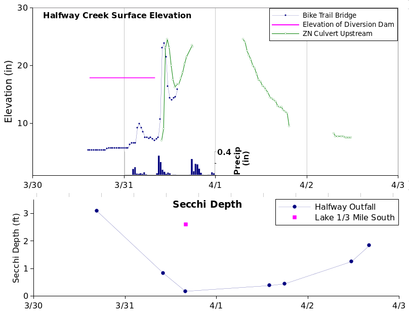
Gaps in the surface elevation data resulted from some trailcam equipment issues, but overall the trailcam monitoring method looks to be feasible. Basin lag (the time lag between precipitation up in the watershed and downstream surface elevation increase) was shorter than expected, on the order of 2 hours. Water remained clear a short distance away from the Halfway Creek sediment plume, with nearby Secchi observations remaining at about 3 feet while the Halfway Creek plume readings were only 2 inches.
March 16, 2023 Discharge Event
With spring melt just beginning to thaw the ground, the Halfway Creek watershed received about 0.6" of warm rain on the afternoon of March 16, 2023, and proceeded to discharge muddy sediment-laden water into Lake Onalaska. Our citizen science monitoring wasn't quite ready to go yet, but we did capture some aspects of the event at the upstream end of the Highway ZN culvert:
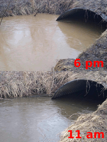
Also, later in the evening, a short video clip was captured of the turbid discharge at the Highway Z culvert where Halfway Creek discharges into Lake Onalaska. This location will be a trailcam monitoring site.
A video clip at the CTH XX bridge at 6pm contrasts the turbid Halfway Creek water with the relatively clear water coming from the Holmen sewage plant outfall.
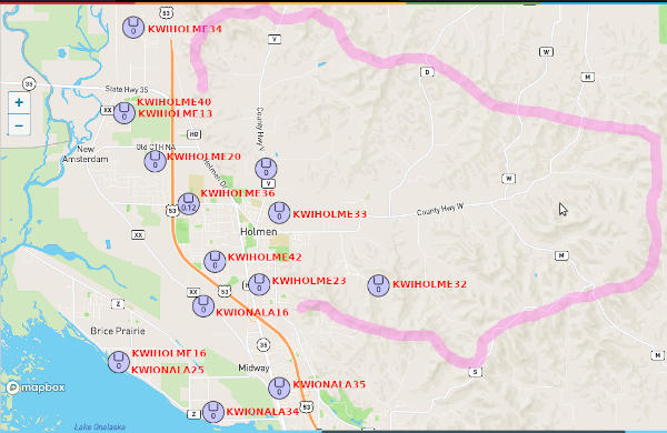
The rainfall event was also a good first test of the grant component to capture crowd-sourced precipitation from within the Halfway Creek watershed. The "official" La Crosse precipitation for the day was recorded approximately 7 miles from the Halfway Creek watershed at 0.42". Nine crowd-sourced weather stations actually IN the Halfway Creek watershed recorded 0.5" - 0.64", averaging 0.58":
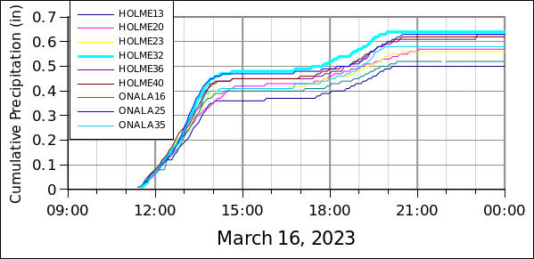
The highest reported rainfall (0.64") was also at the highest elevation (1043 ft - other stations ranged from 656 to 768 ft). Future studies will investigate elevation, spatial patterns and consistency of bias within stations. The available stations are concentrated near the western end of the watershed, but would provide good latitudinal coverage for the prevailing west-to-east storm tracks:
Highway ZN Culvert Measurements
We did some instream work on 19 March to evaluate this site for monitoring. We think these steel posts are part of an old gauging platform, still sturdily placed and usable.
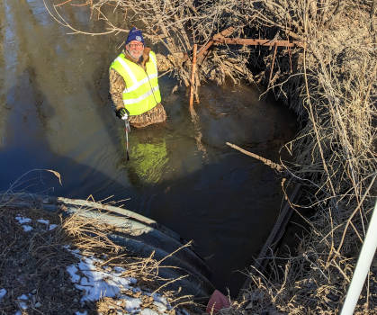
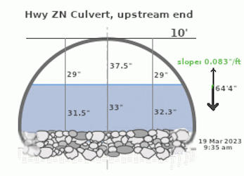
Then we hauled out tape measures and levels to assess the culvert for flow calculations. The culvert is of the "arch" type (flattened bottom), with the lower leading edge protected by riprap which covers part of the bottom. It looks like the flow would be controlled on this inlet end:
